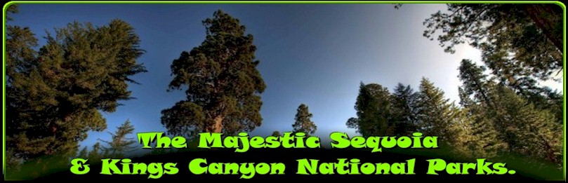
Sequoia National Park is a national park in the southern Sierra Nevada east of Visalia, California, in the United States. It was established on September 25, 1890. The park spans 404,063 acres (631.35 sq mi; 1,635.18 km2). Encompassing a vertical relief of nearly 13,000 feet (4,000 m), the park contains among its natural resources the highest point in the contiguous 48 United States, Mount Whitney, at 14,505 feet (4,421 m) above sea level. The park is south of and contiguous with Kings Canyon National Park; the two are administered by the National Park Service together as the Sequoia and Kings Canyon National Parks.
The park is famous for its giant sequoia trees, including the General Sherman tree, one of the largest trees on Earth. The General Sherman tree grows in the Giant Forest, which contains five out of the ten largest trees in the world. The Giant Forest is connected by the Generals Highway to Kings Canyon National Park’s General Grant Grove, home to the General Grant tree among other giant sequoias. The park’s giant sequoia forests are part of 202,430 acres (81,921 ha) of old-growth forests shared by Sequoia and Kings Canyon National Parks. Indeed, the parks preserve a landscape that still resembles the southern Sierra Nevada before Euro-American settlement.
Park attractions
In addition to hiking, camping, fishing, and backpacking, the following attractions are highlights with many park visitors:
- Sherman Tree Trail An 0.8-mile roundtrip paved trail that descends from the parking lot to the base of the General Sherman tree and meanders through a grove of giant sequoia trees.
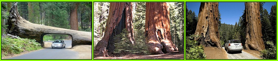
- Tunnel Log is a tunnel cut through a fallen giant sequoia tree in Sequoia National Park. The tree, which measured 275 feet (84 m) tall and 21 feet (6.4 m) in diameter, fell across a park road in 1937 due to natural causes. The following year, a crew cut an 8-foot (2.4 m) tall, 17-foot (5.2 m) wide tunnel through the trunk, making the road passable again.
- Tokopah Falls The trail to Tokopah Falls starts just beyond the Marble Fork Bridge in Lodgepole Campground. It is an easy 1.7 mile (one way) walk along the Marble Fork of the Kaweah River to the impressive granite cliffs and waterfall of Tokopah Canyon. Tokopah Falls is 1,200 feet (365.8 meters) high, and is most impressive in early summer.
- Crescent Meadow is a small, sequoia-rimmed meadow in the Giant Forest region of Sequoia National Park. This sierran montane meadow marks the western terminus of the High Sierra Trail, which stretches from the meadow across the Great Western Divide to Mount Whitney. Pioneer Hale Tharp homesteaded in this and nearby Log Meadow. Conservationist John Muir visited this meadow many times and praised it highly calling it the “Gem of the Sierras”. The meadow lies at the end of a three-mile paved road which leaves the Generals Highway near the Giant Forest Museum.
- Moro Rock is a granite dome located in the center of the park, at the head of Moro Creek, between Giant Forest and Crescent Meadow. A 400-step stairway, built in the 1930s by the Civilian Conservation Corps, is cut into and poured onto the rock, so that visitors can hike to the top. The stairway is listed on the National Register of Historic Places. The view from the rock encompasses much of the Park, including the Great Western Divide. It has an elevation of 6,725 feet (2,050 m).
- Campgrounds in the park include three in the foothills area: Potwisha (42 sites), Buckeye Flat (28 sites), and South Fork (10 sites). Four campgrounds are at higher, conifer-dominated elevations, ranging from 6,650 to 7,500 feet (2,000 to 2,300 m): Atwell Mill (21 sites), Cold Springs (40 sites), Lodgepole (214 sites), and Dorst Creek (204 sites).
- Giant Forest Museum offers information about giant sequoias and human history in the forest. The historic museum was built in 1928 by architect Gilbert Stanley Underwood.